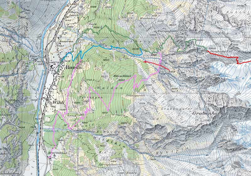
Map 1. Ascent to the Domhütte. Beginns at the church in Randa (green line). Blue line is trail to the Domhütte on the Swiss map, violet lines are possible trails when going from the camp Randa. These are however, together with the original trail, endangered by the stone avalanches (red arrow) and abandoned.
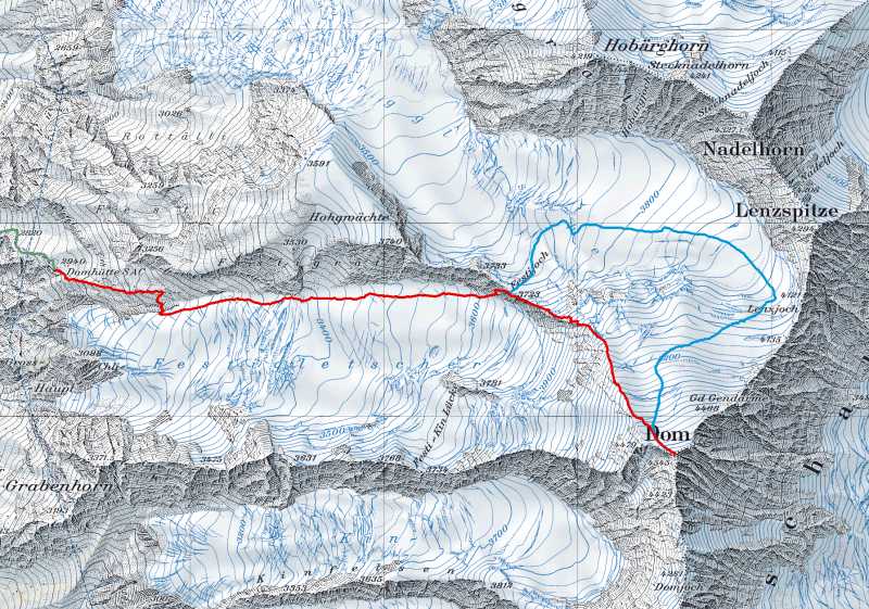
Map 2. Ascent to the Dom over the Festiggrat (red line) and descent over the normal route to the Festigjoch (blue line).
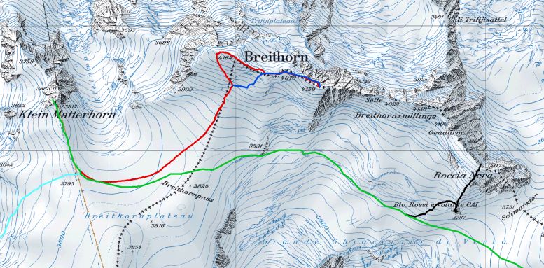
Map 3. Klein Matterhorn and Breithorn ridge. Breithorn ridge summits - from the left - Breithorn West 4164 m (main summit, west summit) - Breithorn Middle 4159 m (without name on the map) - Saddle 4022 m (Selle) - Breithorn East 4139 m (Breithornzwillinge on the map, = twin) - Gendarm (second twin) - Roccia Nera. See list of the tracks in the table.
We did not have GPS while climbin Breithorn ridge. Access follows the green line until p. 3824, than deviates to the left following contour 3800 m, than - under Breithorn Middle - starts to rise slightly to reach the distance between bivouac Rossi and the ridge somewhere in the middle (on the black line).
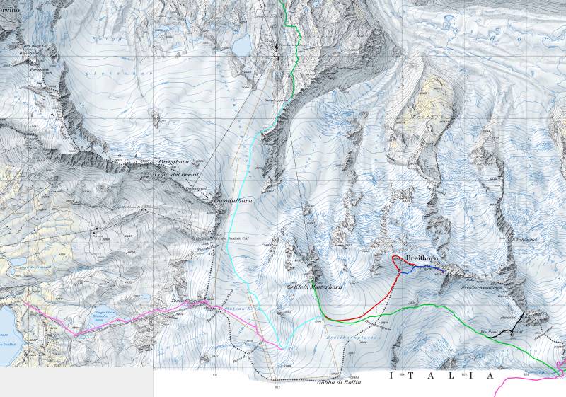
Map 4. Tracks for the region of the Breithorn plateau. See list of the tracks in the table.
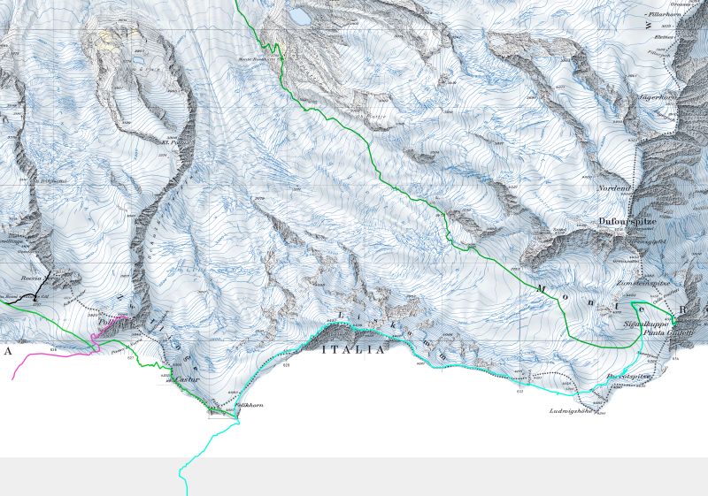
Map 5. Tracks in the region of Pollux, Castor and Liskamm.
Table - list of the GPS tracks
| track name | description | color | origin |
| Randa-DomH | Randa - Domhütte | green | own recording |
| Festiggrat | Domhütte - Dom over Festiggrat | red | own recording |
| Dom-Festigjoch | descent from Dom to Festigjoch | blue | own recording |
| Kmatt-BreitH | Klein Matterhorn - Breithorn West - Breithorn Middle | red | own recording |
| BreitHM | descent from Breithorn Middle | blue | own recording |
| Italy-plateau | from Italy over Trockener Steg to plateau | violet | own recording 2006 |
| Kmatt-BRoss-Rnera | Klein Matterhorn - Bivouac Rossi - Roccia Nera | black | own recording 2006 |
| Furi-GandegH | station Furi - Gandegghutte | sky-blue | Swiss Map |
| GandegH-plateau | Gandegghutte - plateau | sky-blue | Alpin-coordinaten.de |
| Kmatt-FeligH | Klein Matterhorn - Castor - Felighorn | green | Alpin-coordinaten.de |
| RAyas-Pollux | Rif. Ayas - Pollux | violet | Alpin-coordinaten.de |
| Liskamm | Quintino Sella - Liskamm - Rif. Margeritta | blue | Alpin-coordinaten.de |
| RotenB-Margeritta | station Rotenboden - Monte Rosa Hutte - Rif. Margeritta | green | Alpin-coordinaten.de |
Tracks are edited - removed obvious mistakes in measurement (jumps), lumps at the sites of stops etc. Tracks are also sometimes combined from pieces from different sources - e. g. to pick just one recording for section covered by more tracks or to create track with desired course.
GPX file for download (13 tracks - see Table, 65 waypoints)